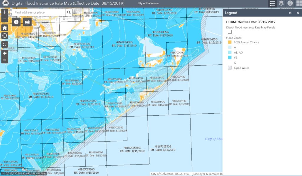
So, What’s up with the New Flood Maps?
In the aftermath of Hurricane Ike, the inherent risk of flooding on Galveston Island became very apparent. Homeowners and potential buyers have become very mindful of flood risks and flood insurance costs associated with owning a home. And just when we were all becoming vaguely familiar with flood insurance policies, FEMA changed the flood maps. On August 15, 2019 FEMA released a new Galveston flood map that shapes the flood insurance policies and helps residents determine if they are in a low to moderate, or high risk flood zone. Click on the link below to view the new map:
https://galveston.maps.arcgis.com/apps/webappviewer/index.html?id=ef5190792f794b44a8bcb84b02ac4c7c
The most common zones in Galveston indicated on the flood map are Zones AE 10, AE 12, and Zone X. Zone X is the most favorable flood zone, and it means that the base elevation is high enough to make flooding a very low risk. AE 10 indicates that the base flood elevation is 10 feet and AE 12 indicates that the base flood elevation is 12 feet. Generally speaking, if the bottom floor of your home is above the base flood elevation, your home will qualify for low flood rates.
Insurance underwriters rely on an elevation certificate, which shows the elevation of a home and other variables that determine your flood insurance rates. Insurance underwriters are relying even more on elevation certificates since the new maps came out. While your property may be grandfathered in to a rate, you may be eligible for better rates with an elevation certificate. Having an elevation certificate may also help lock in your current rate and prevent annual rate hikes. An elevation certificate is performed by a surveyor and they cost around $300-$400. My go to resource for elevation certificates and surveys is Laurence Wall with Texas Land Title Surveyors. https://www.texaslandtitlesurveyors.com/. I also recommend reaching out to a local insurance agent to make sure that you are getting the best coverage.
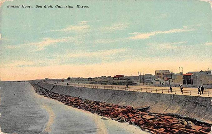
As a real estate agent in Galveston, the most common questions that I hear from buyers is “Has this house ever flooded?” or “What are the flood insurance rates on this house?” Most real estate professionals have become hyper aware of these concerns and typically have an answer prepared when showing a home or know where to find the answers. One thing that many residents and prospective buyers in Galveston may be unaware of is that the elevation is typically higher closer to the beach. While this may seem counter intuitive, it is a result of the seawall construction and grade raising in 1904. The seawall is approximately 17 feet above sea level and the land slopes down gradually towards the bay side. Therefore, as a general rule of thumb, homes closer to the seawall are going to have higher elevations and more favorable flood rates. This is evidenced on the flood map. There are other variables that come in to play, such as how high the house is raised and what types of venting is used on the ground level. Once again, refer to your local insurance agent to make sure that your house is covered by a policy and that you are getting the best rate.
Check out some of my listings at https://thegalvestonrealtor.com/category/for-sale/ and call me to see what types of flood policies these homes qualify for.